
23/05/2023 - Powderface Ridge

 Powderface Ridge

Written By Marsiol Harvey

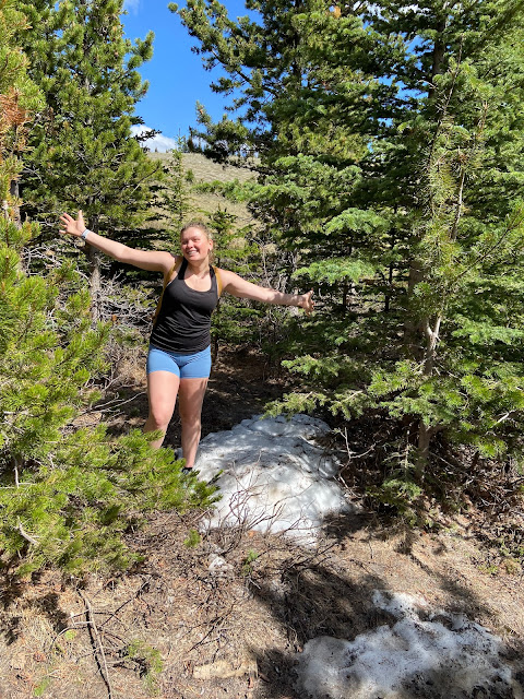
Today, Amanda and I hiked Powderface Ridge. I was lucky enough to have my shift changed at work and decided it was perfect weather to go on an afternoon hike. When I went and attempted to summit Powderface a few weeks prior I didn't quite make it. I made the poor decision of hiking along the Powderface creek trail and after a few too many kilometers alone in the rain I decided to turn around.

Today however, we had a bit more luck with the weather. We were both surprised at how empty the trail was but figured everyone was at work since it was the day after the long weekend, or avoiding outdoor activity due to the smoke from forest fires. The air quality report this morning was a 2 on the Air Quality Health Index which posed low risks to our hiking plans. We had a late start around 3pm with very few clouds or smoke in sight. During our ascent, we enjoyed great chats about F1, hockey, skiing, and Amanda's recent trip to Europe.


On the way up 

At around 2.7km, we got to a bend in the trail and the winds picked up significantly as we were above the tree line and much more exposed. We decided to head to the false ridge rather than continuing to the very top of Powderface (I think we would've been blown off the mountain). It took us approximately an hour and a half to reach the false summit at 7,000ft. Nonetheless, we still enjoyed gorgeous views and amazing visibility. We could even see Calgary in the distance, despite the thick smoke that had recently been in the area. 


Summit Pics

We enjoyed a quick break at the top, and began our descent. Around 1 km from the bottom we encountered a little friend, a dear, who quickly hurried away once he heard the loud conversations we were having about Amanda’s boyfriend, Roger Federer. Overall, it was a really fun girls hiking trip and I'm looking forward to more in the future. 


Comments

Popular posts from this blog

06/01/25 - Windtower II

  Windtower (2nd Time)  This has somewhat become a tradition for my buddy Sam (another different Sam, I'm not talking in the third person) and I (we completed our first summit last year on January 1st). This year we were joined by Sam's buddy Joe, making a trio for the second summit attempt. Last year proved to be quite difficult as were were quite unprepared and were not expecting the length we encountered. The day was shaping up to be a good one as the skies were clear and just as we arrived at the trailhead the sky was beginning to brighten. The car thermometer was reading negative fifteen degrees, but it actually felt pretty mild as it was still outside with little to no wind. Our ultimate push was the summit, but our mindset was to get there in the most fun way possible and we weren't against turning around if the conditions weren't favourable. Joe and I were armed with Microspikes and a Black Diamond Raven ice axe each, while Sam was equipped with dedicated Petzl ...

12/08/2024 - Smutwood Peak

 Smutwood Peak 50° 48' N, 115° 24' W Quite possibly the craziest hike of the summer for Sam and I. After completing the fairly lengthy drive to the trailhead, we started our walk around 8:00am. The only other car when we got to the trailhead was a grey Toyota with a Yeti SB 160 loose in the back - kind of weird to just leave it there. The approach to Smutwood peak begins with around 4km of flat low level walking through lush forrest. Even so, the views are incredible and there is lots to keep your eyes busy. Around 2km into the hike there is a pretty incredible falls that we stopped at for some water and a slight breather. One of the reasons this hike is spectacular is due to the fact that during the approach and even on the ascent you are exposed to some of the most spectacular peaks in this region of the Rockies.  On the right side of the approach, The Fist and Mount Smuts can be seen, menacingly looking down at you. Straight ahead Mount Birdwood is visible, a constant remin...

04/01/25 - Wasootch Ridge

  Wasootch Ridge 50.97° North, -115.09° West Having been in Montréal for the past four months, this was to be my first major hike back. I would be joined by my buddy Sam for the attempt at the summit. Whenever Sam and I get together to hike, it is never a dull day, and today would be no different. I've completed Wasootch once before and reached the summit and dropped off onto the backside and retreated via the creek bed. Although it was a viable option, the creek bed is quite difficult to get down to off the backside of the final peak of the ridge, so today the plan was to avoid it and retreat back down the ridge. If you complete the whole ridge and manage to reach the summit, Wasootch is around 15km and 1100m of elevation gain; not a wee day out! We started our push for the summit sometime around 8:30 after some pre hike fuelling at A & W.  Our route, stopping just before the high point Other stats from our walk The day shaped up to be a beauty, marked by low level cloud ...